Alberta Maps Home > Alberta Map Collection > Map of Alberta
Alberta province map: entire province
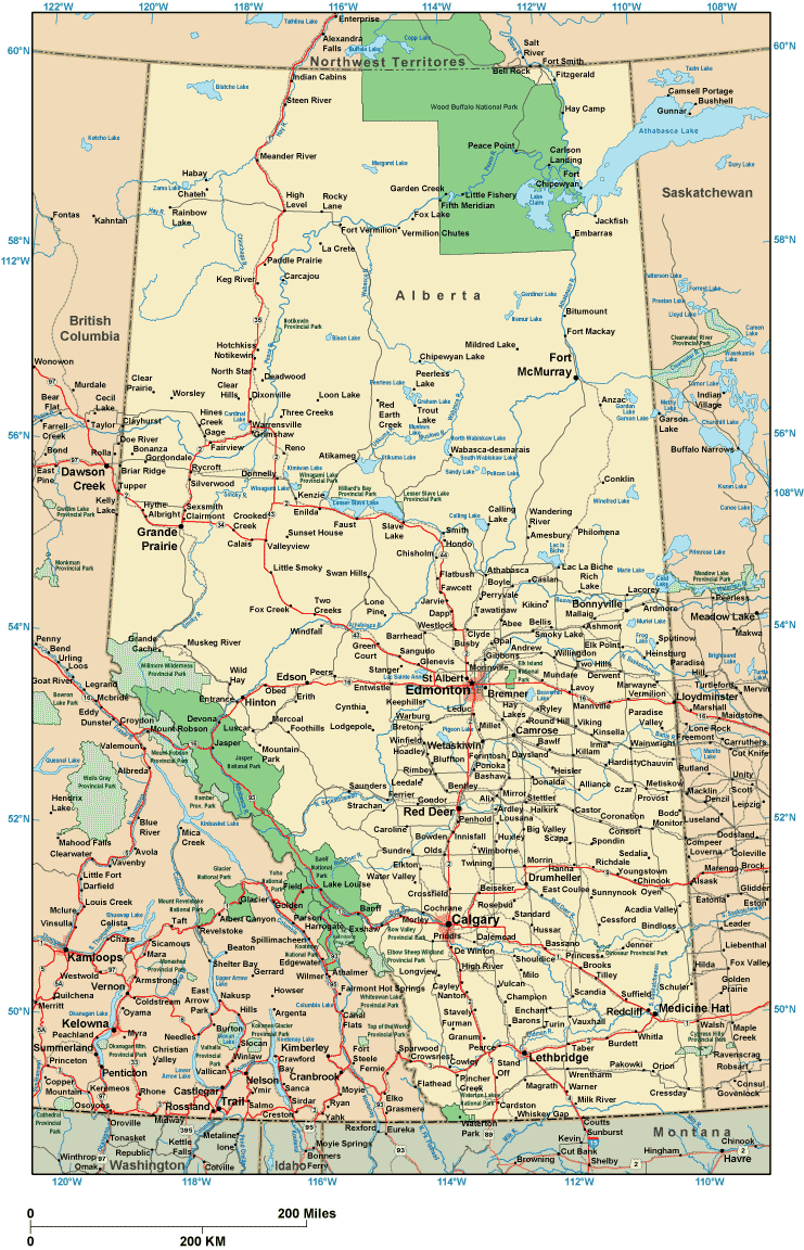
This map image is a simple plot setting out the geography of this area of interest with a classic group of map elements.
You are allowed to print this image and work with it in your projects. Giving credit to this source is always appreciated. Thank you.
In case you are hoping for assistance acquiring a map, a distinct kind of map, or are hoping for a first-class custom preparation, please do not hesitate to contact us.
Order first-class custom-built maps from us. A custom map made by us provide a huge group of map components, for example: alleys, map projection, UTM coordinates, channels, islands, seas, forests, or rivers, etc. Map types go from cultural to relief, large-print to small-print, county level to consolidated cities.
First-Class maps are detailed, well-defined, and not deceptive. Expert map-making by YellowMaps.
To procure printed maps or charts, such as recreation atlases, maps of continents, or maps for canoeing, please browse our map shop It has over 100,000 products.
When in doubt, just ask us. We answer emails quickly.
Back to Alberta map collection